![]()
![]()

|
|
|
|
Breach
at Atlantique
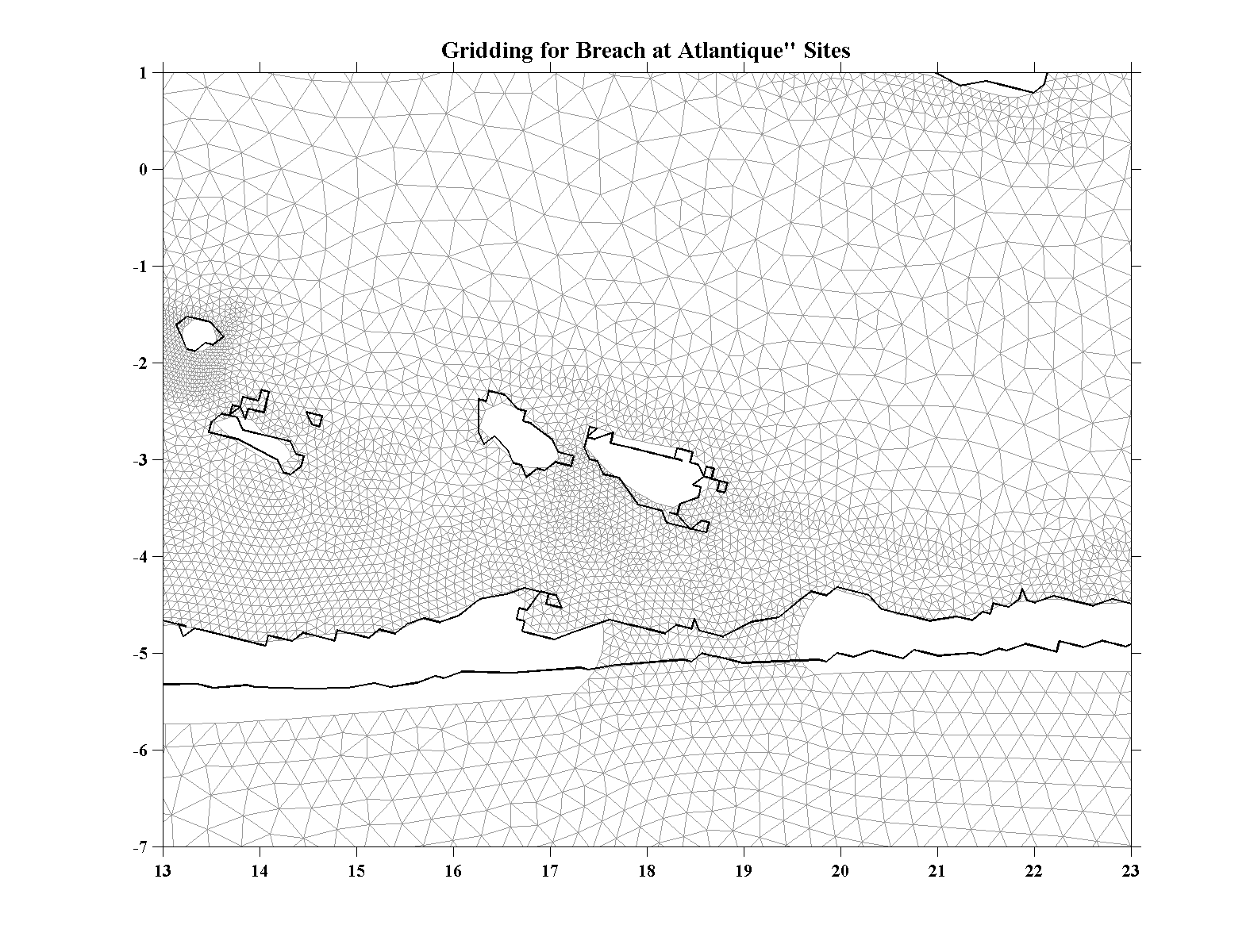
| Gridding - For a second breach location we looked for another area where a breach seemed likely. Barretts Beach is often mentioned as a possible site since Fire Island is narrow there. However, there is shallow water for a considerable distance north of that location. An alternative location that is also listed as a potential breach location is Atlantique where the the island is also narrow. But here there is deep water on the backbay side which might facilitate the opening of a substantial breach even though Fire Island Inlet is only some 10 km to the west. For this breach scenario we excavated a channel through Fire Island which is about 2 km wide at this point, with a cross-sectional area of about 3300 m2 (36,000 ft2). As before, a certain amount of dredging was required north of the inlet to blend in with the existing bathymetry. With the addition of the breach there was 60635 nodes and 116837 triangular elements. As in the base-case we ramped-up the Atlantique breach simulation from an at-rest condition for 200,000 internal time steps (see discussion for the base-case). |
|
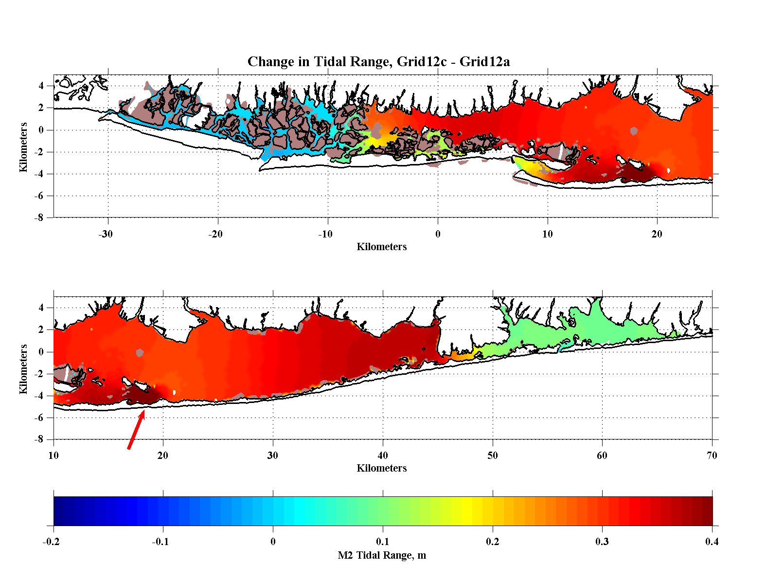
| Tidal Range - The tidal range with the Atlantique breach increases significantly relative to the base-case throughout the Great South Bay and to a lesser degree in Moriches Bay. In the western portion, as in the Old Inllet case, there is little change between Seaford (at -8 km) and Jones Inlet while farther west north of Atlantic and North Beaches tidal ranges increase within the channels. Within the central portion the tidal range is larger than either the base-case or Old Inlet scenarios and increases uniformly into Bellport Bay. In the central portion the tidal range increase is about 0.3 m while it is more than 0.4 m in Bellport Bay, in the immediate vicinity of Atlantique and south of Hempstead. |
|
| Temperature and
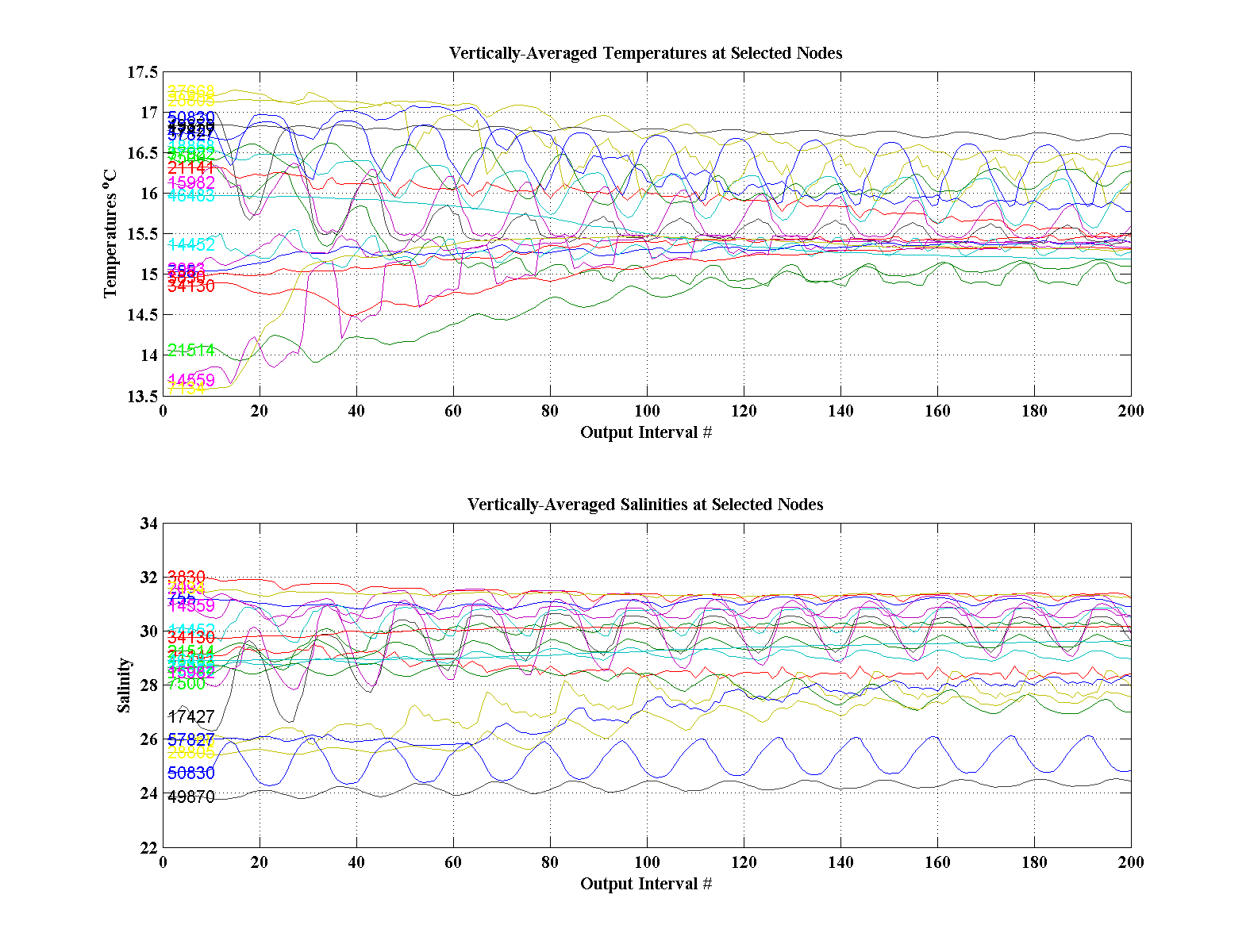
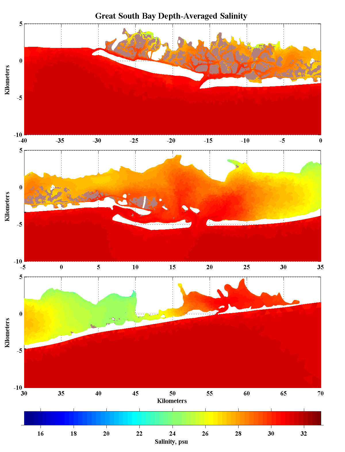
Salinity - As for the base-case, the simulation was started from rest with climatolgical temperature and salinity distributions. Temperatures are not forced in the present version of the model through air/sea interaction and so slowly equilibrate due to the river and oceanic effects. The response of salinity to the opening at Atlantique is interesting. The nodal salinity records in the upper pannel suggest that the salinity balance reached a near equilibrium with an Atlantique breach more quickly than with the Old Inlet breach especially in the central portion of the Bay. Perhaps part of this is because the response in the middle of the Bay was rather less than one might expect from the large increase in tidal range there and the proximity of the Atlantique breach while the changes in eastern Moriches Bay are larger than in the Old Inlet case but less pronounced in the Smith Point Channel area. In the vicinity of Atlantique and to the east of the Fire Islands the increase is 2 to 3 psu while it is almost nil or perhaps slightly fresher south of Lindenhurst. |
|
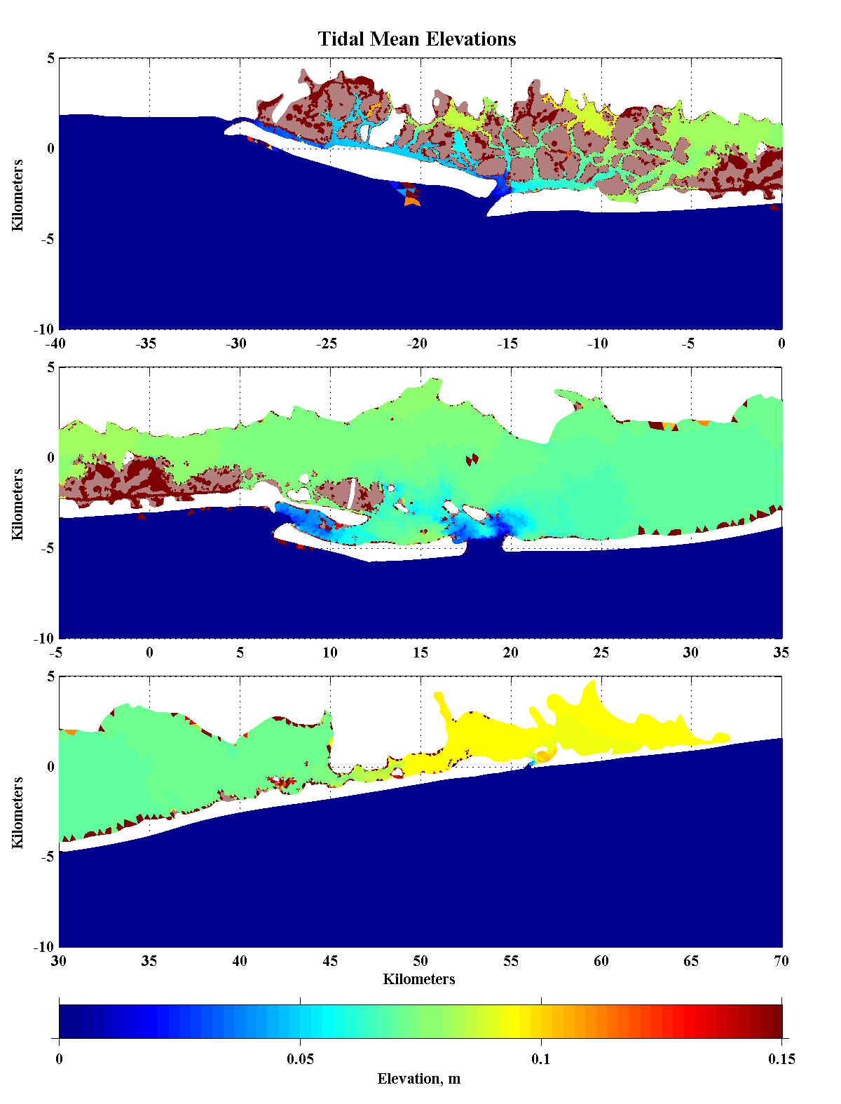
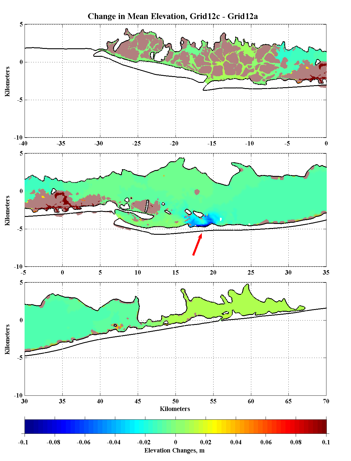
| Tidal-Mean
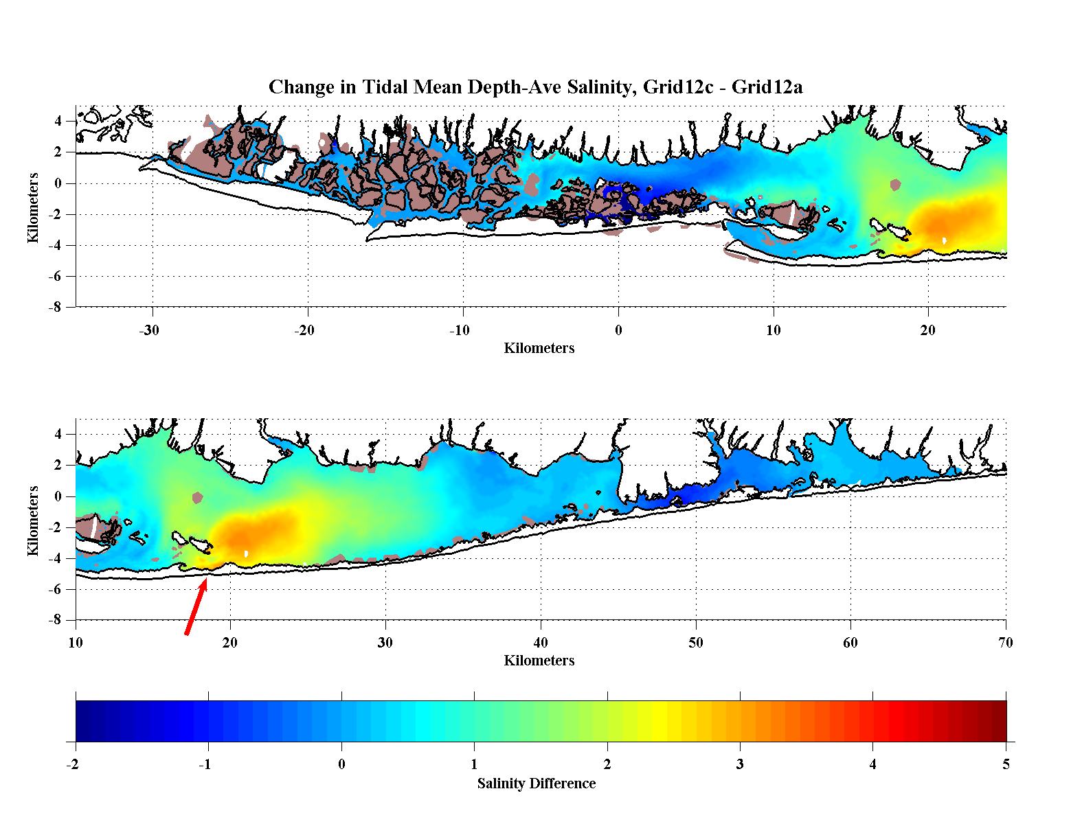
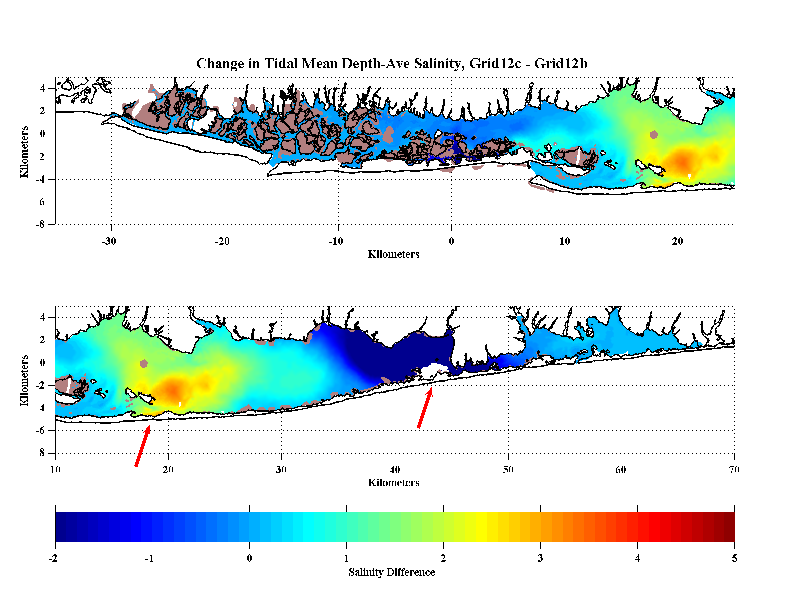
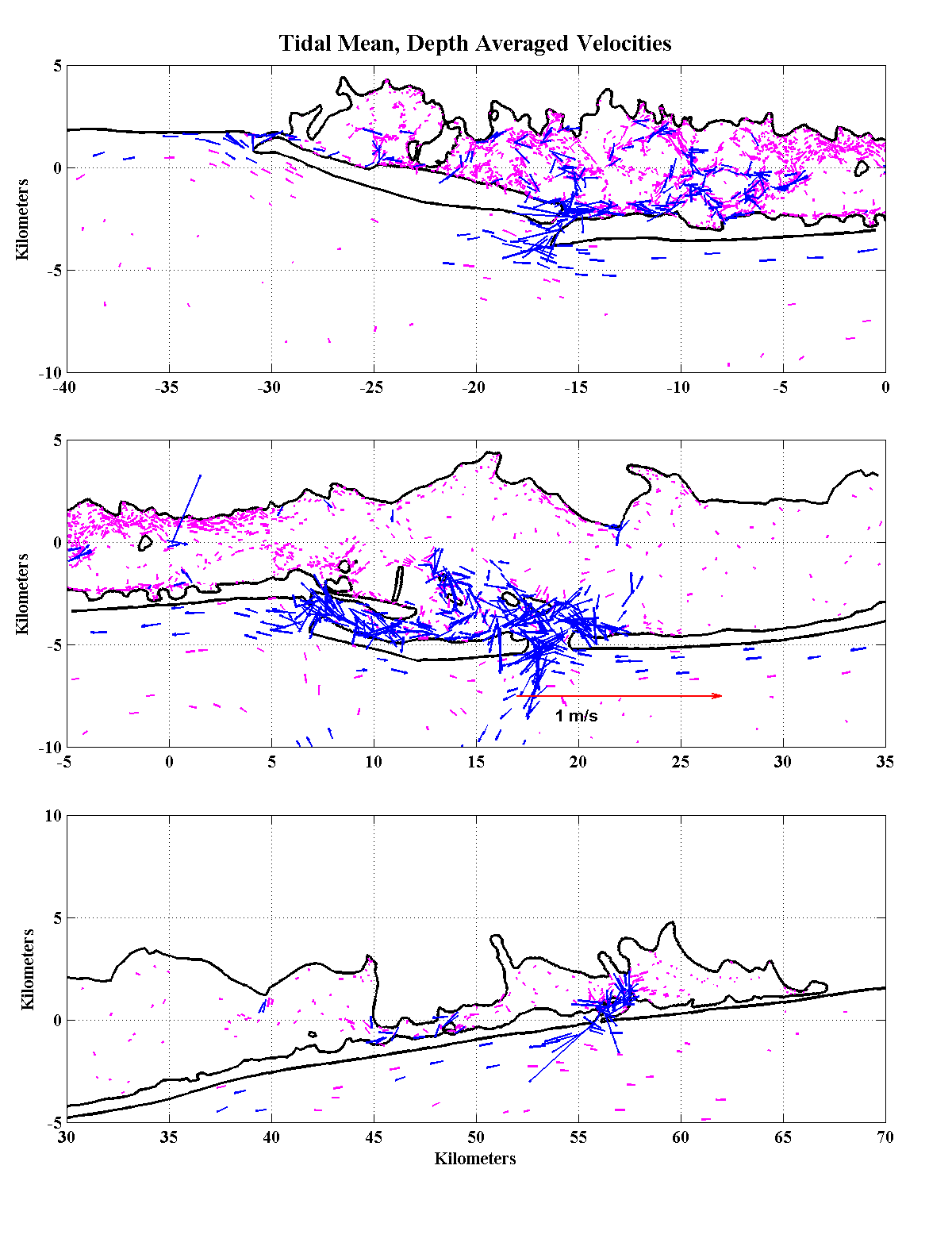
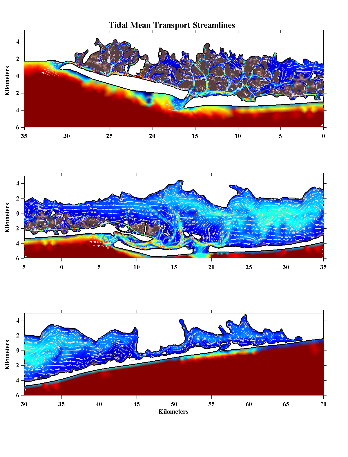
Conditions- The panels below show tidal-mean conditions from the last 12.4 hours of the ramp-up past the time when stable tidal conditions had been reached. The first panel shows the setup of sea level due to tidal forcing while the second panel shows the difference in mean elevation within the Bay that occurs as a result of the breach at Atlantique. As in the base case, the mean elevation inside the Bay is higher than the open ocean as a result of the Stokes flow associated with the shoreward propogating tides through the inlets. However for most of the Bay, the set-up is less than in the base case, particularly so between Jones and East Rockaway Inlets. The set-up in Moriches is higher than elsewhere but changed little compared to the base case while in the marshy area around Gilgo Island (north of Fire Island Inlet) the set-up increased by more than 10 cm, presumably because of the increased tidal forcing around the periphery of this convoluted area. The vertically-averaged salinity under the Atlantique breach conditions shows a substantial increase in the areas within 5 to 10 km of the opening. The time history of salinities at the various nodal positions suggests that the salinity distribution had reached an near equilibrium. This suggests a greater degree of exchange and mixing in the central portion of the Bay as a result of the Atlantique breach as compared to the more remote breach at Old Inlet. The salinity distributions at the east and west ends of the Bay appear to be effected in only a minor way while the salinity distribution in Moriches Bay seems to have undergone and east-west shift, getting more saline to the east while being slightly fresherin the western sub-basin. The differences between the Old Inlet and Atlantique breaches are rather what one would expect; Bellport Bay is much fresher under the Atlantique breach scenario while the central Bay is more saline. The tidal mean currents under the Atlantique breach simulation show considerable residual velocities in and around the Fire Islands relative to those under current conditions. Larger westward flow out of the Smith Point Channel is also predicted. The tidal mean transport show an interesting contrast to the base case and are more similar to the Old Inlet breach in terms of exhibiting a much reduced eddy field. Whereas the eddies in the Old Inlet case were subdued to allow for an eastward flow out of the breach, the situation for the Atlantique breach has reversed the tidal mean currents so that they flow westward as a result of the increased tidal range and elevation in Bellport Bay. Despite the reversal of flow in the central portion of the Bay, the eastward flow south of Lindenhurst and Babylon remains. |
|||||||||
|
|||||||||
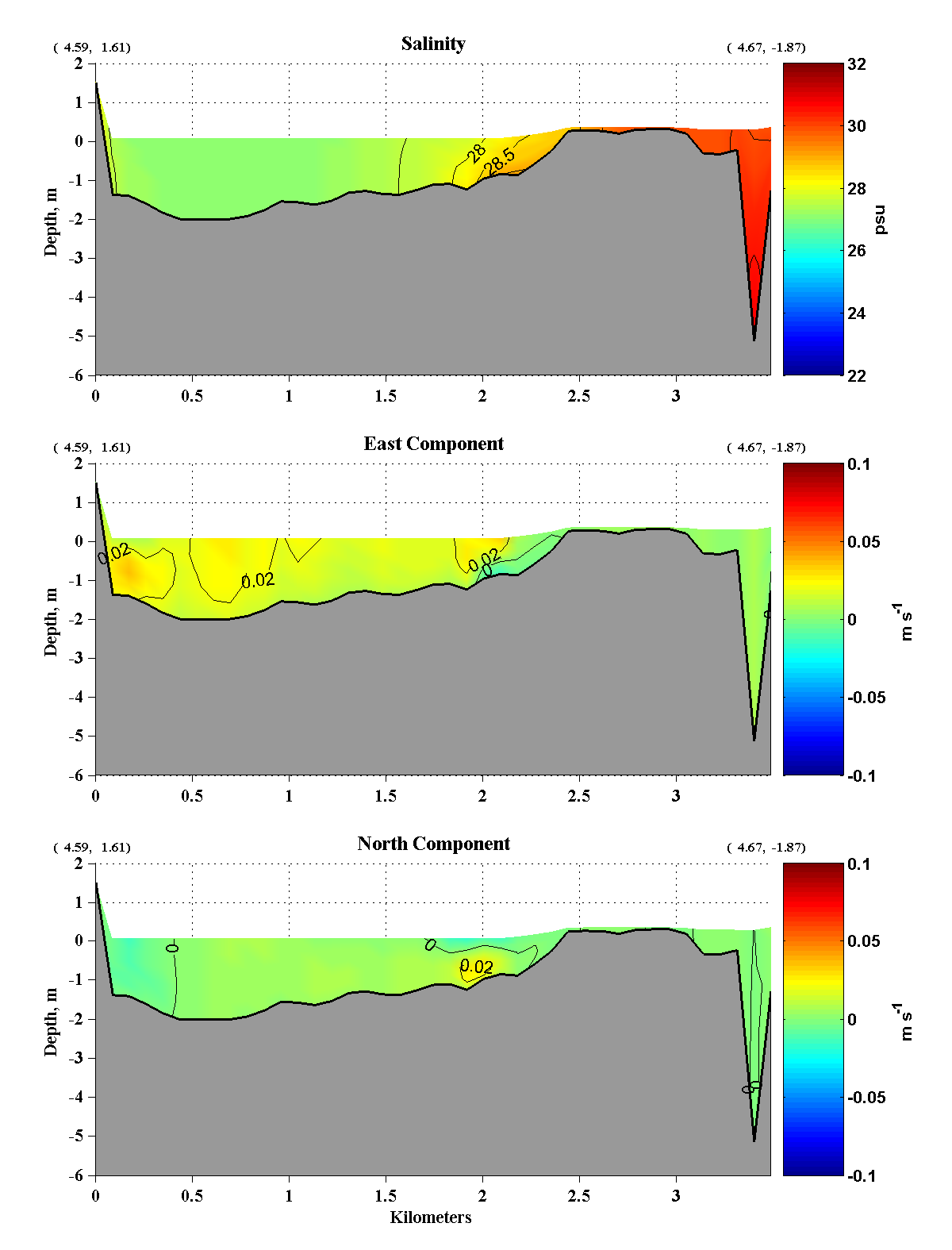
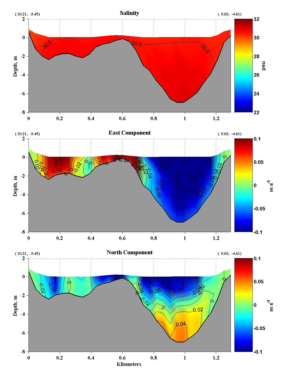
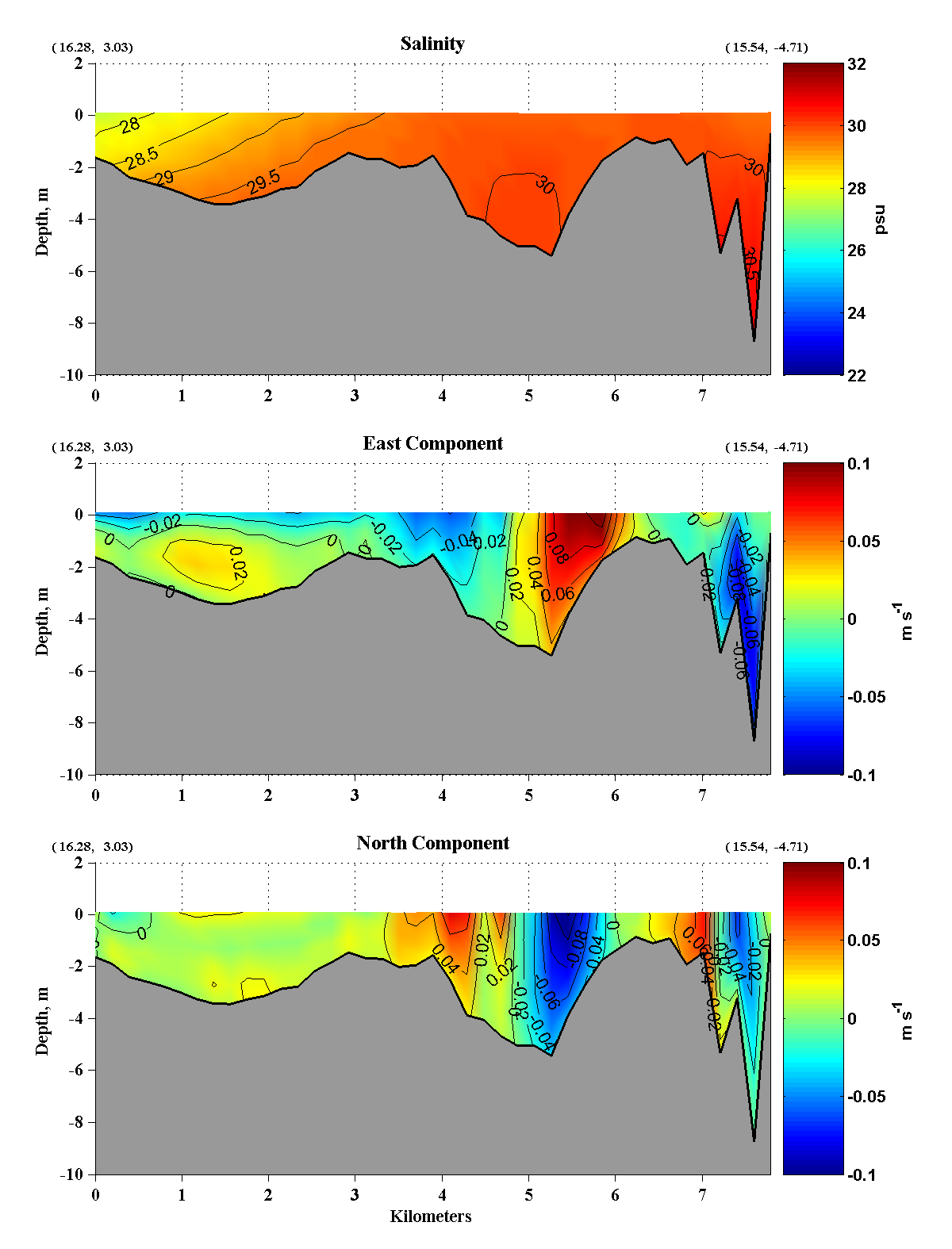
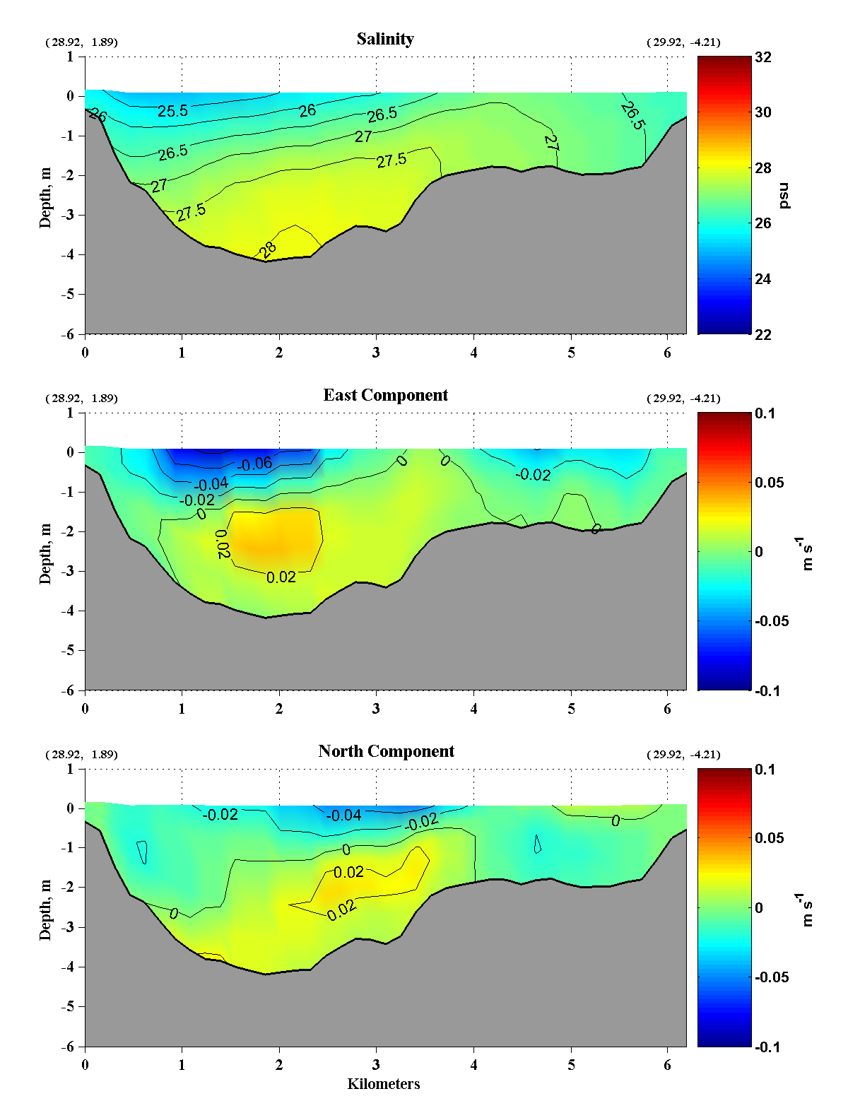
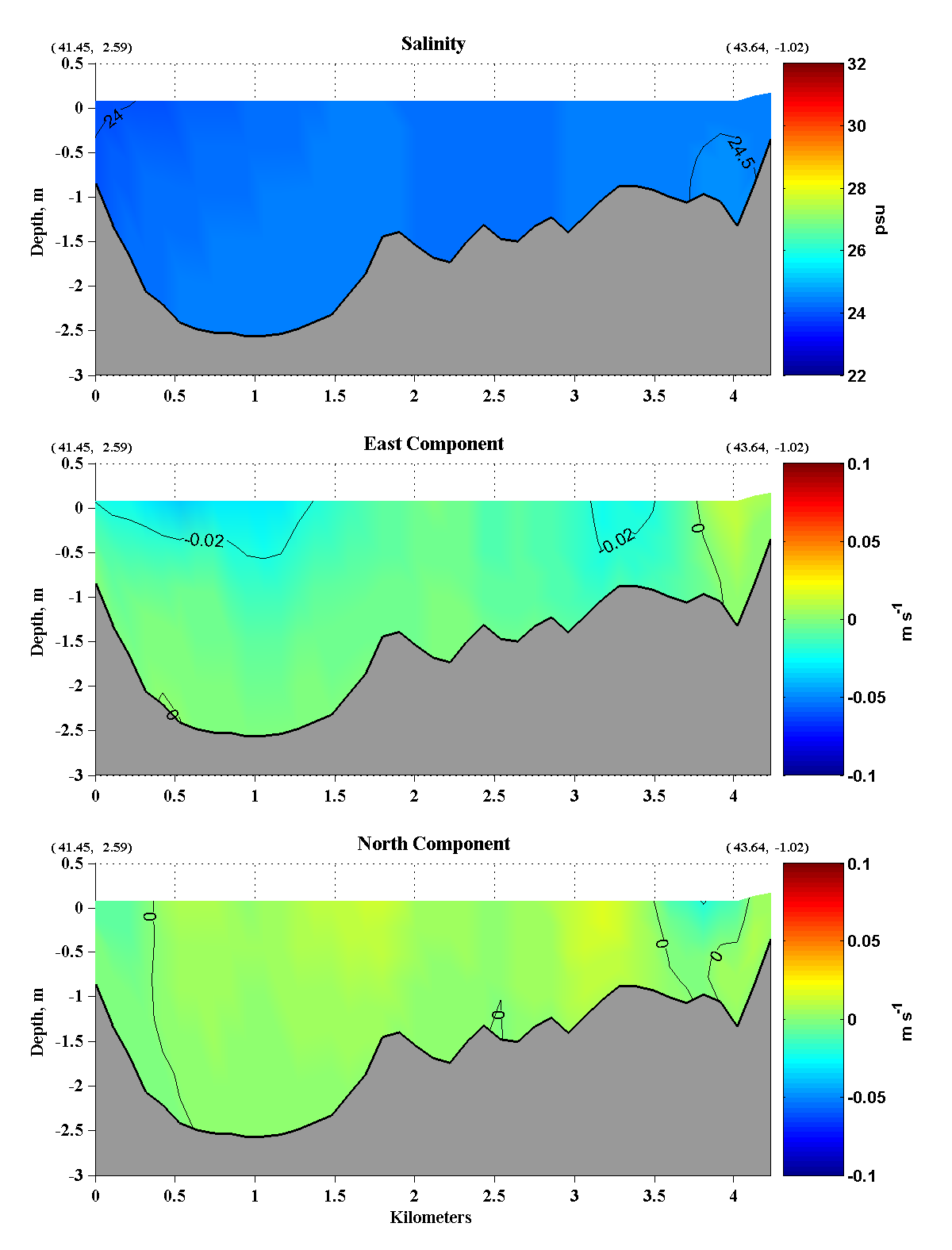
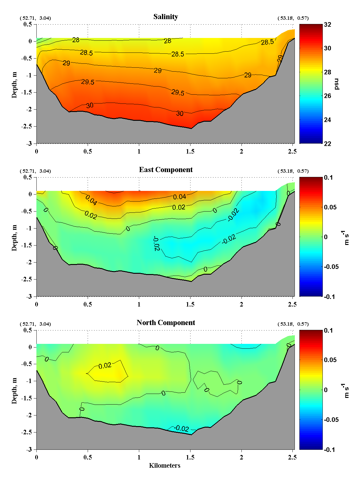
| Vertical Sections
A series of sections have been generated to show the vertical and
horizontal structure of the salintity and velocities under the Old
Inlet breach scenario. The chart below shows the locations of the
vertical sections while the lower panels show vertical sections of the
tidally-averaged
salinity and nominally, east and north velocity components. (The
velocity components have been rotated 15o to be
aligned along and across the Bay so that the "east" component is
actually toward 75oT while the "north" component is toward
345oT.)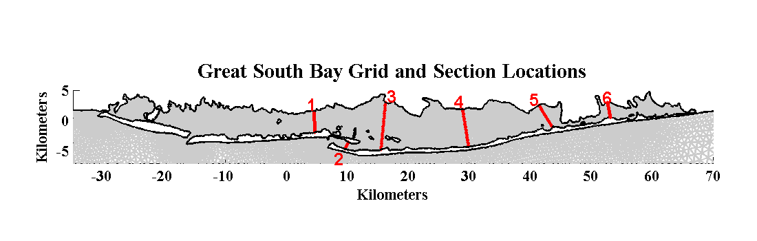
The breach at Atlantique
has again altered the flow patterns in areas other than its immediate
vicinity. In section 1 south of Lindenhurst the salinity has
increased slightly while the eastward currents have spread out and
there is no longer any southwestward near surface flow. There are
some significant differences in the Fire Island Inlet section (2)
compared to the base case. While the tidal mean salinities are
almost identical , with a slight increase, the currents in the channel
have clearly become more intense with higher velocities reaching deeper
into the channel and greater inward flow over the shallow northern half
of the section. This perhaps is not what one would expect with a
new breach so close which one would assume would divert much of the
tidal residual flow away from the existing inlet. The greatest
change has occurred in section 3 south of Islip and closest to the
breach. Here the salinity has increased by ~1.5 over almost the
entire section while the residual currents in the southern half of the
section have increased in magnitude while reversing to the west in the
southern most deep channel that supplies the outflow from Fire Island
Inlet. In section 4 south of Sayville the salinity has increased
across the entire section by about 1 compared to the base case while
the mean residual westward current has shifted from the southern
shallows to the north shore to feed the outflow through the
breach. In the Bellport Bay section (5) the salinity distribution
has become both saltier by about 0.5 and less stratified than
before. The reduced stratification may come from the greater tide
range in that area and the attendant higher currents which would
serve to increase the local mixing. Unlike the sections in the
main part of the Bay, the western portion of Moriches Bay is fresher
than before by about 0.5 while vertical shear in the residual east
current has increased with greater eastward flow near surface and
greater westward flow near bottom. While there appears to be a
greater export of water westward through Smith Point Channel it is
unclear how the changes in residual current supply this as they may
reflect more of a shift and an intensification of the residual eddies
in Moriches Bay. |