![]()
![]()

|
|
|
|
Model
Domain and Gridding
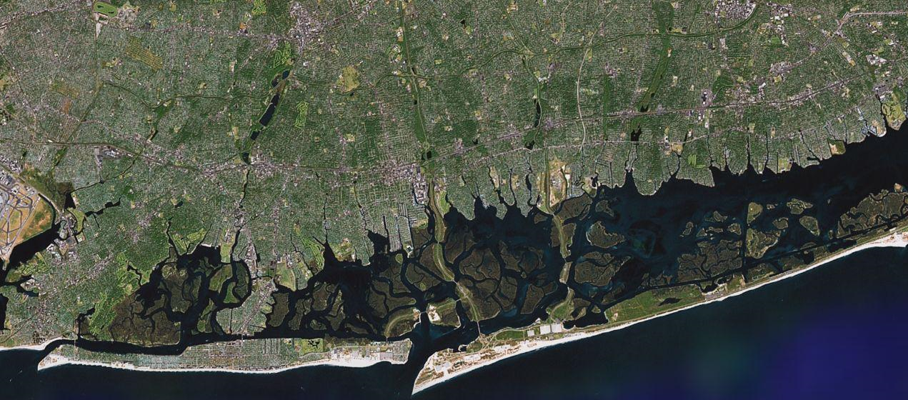
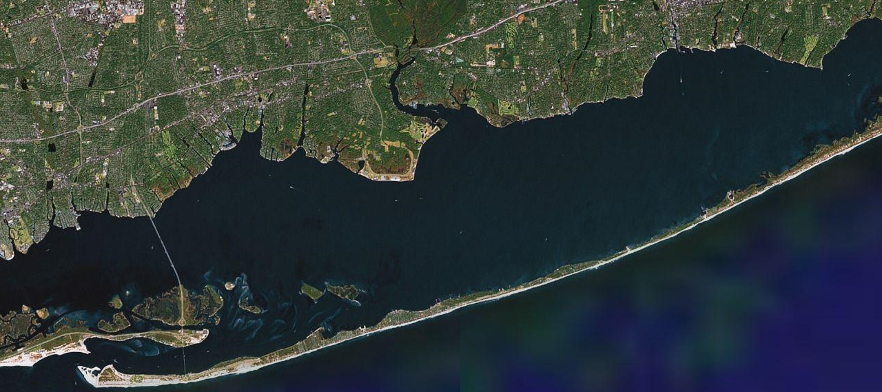
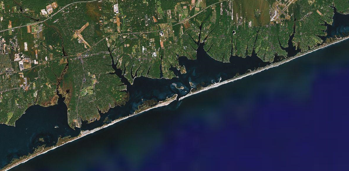
| The model domain stretches from Rockway Inlet to the west, eastward some 75km to the Quantuck Canal between Moriches and Shinnecock Bays. While the central portion of Great South Bay is the central focus of the study, the inlets to the east and west have a large effect on the exchange properties of the region which meant that we had to cover the entire area. The figures below, from Goggle maps, show the area. Note that the western end of Great South Bay is very complicated with many mud flats and narrow chanels which dictated the high spatial resolution needed to adeqautely simulate the flow through the area. | |||
|
|
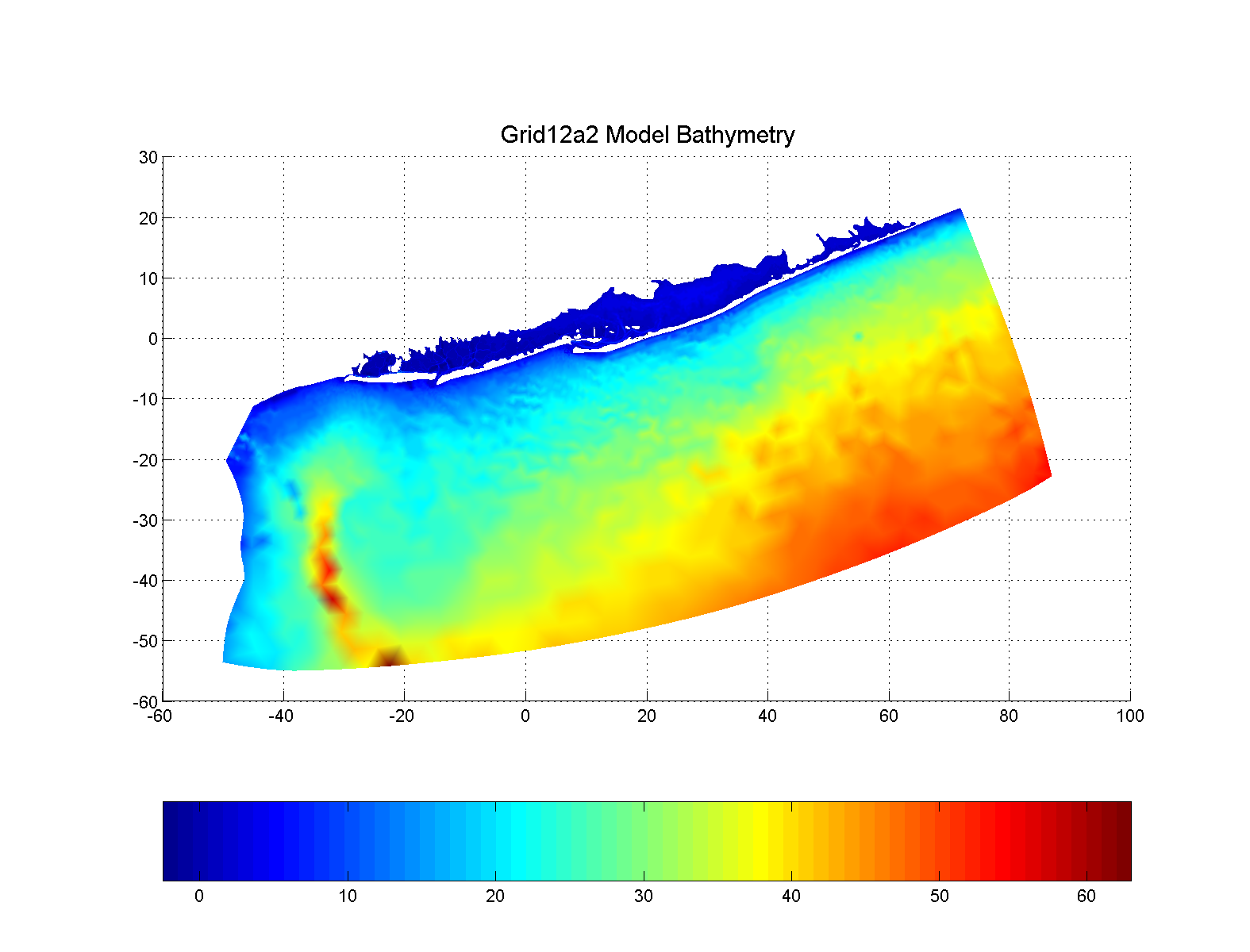
Initially, we had
intended to extend the grid offshore only onto the continental shelf in
small
regions surrounding each of the four inlets. After a number of test
runs we realized that the tidal phasing between the inlets could have a
significant effect on the residual flow within the Bay and was not
easily parameterized. As a result, the grid was extended offshore to
approximately the edge of the continental shelf and east and west from
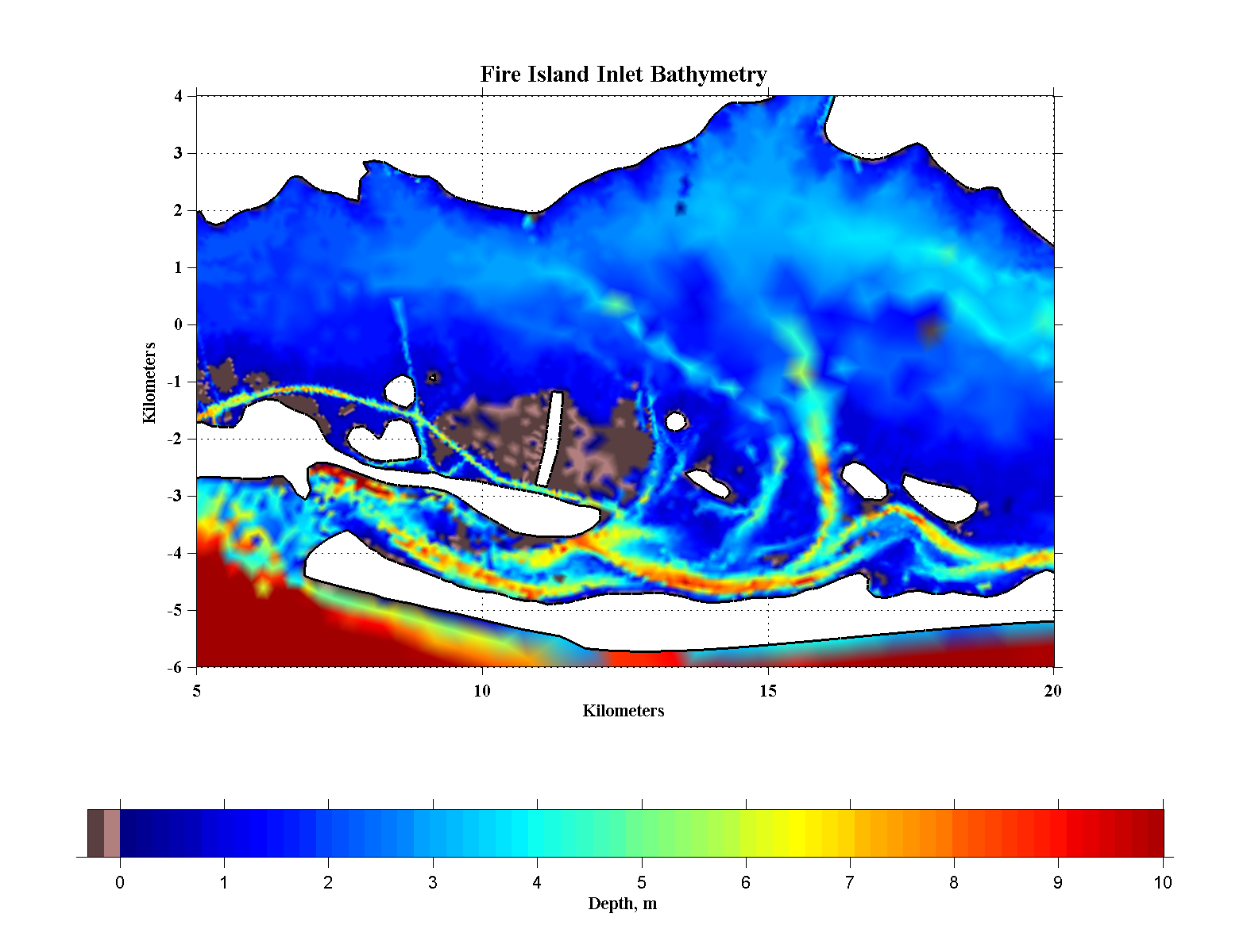
Sandy Hook almost to Montauk Point. The figure to the right shows the
bathymetry over the
extent of the model domain. Tidal boundary conditions along the
outer boundary and in the entrance to New York Harbor were determined
from a larger-scale run of the barotropic ADCIRC model for the entire
New York Bight. |
|
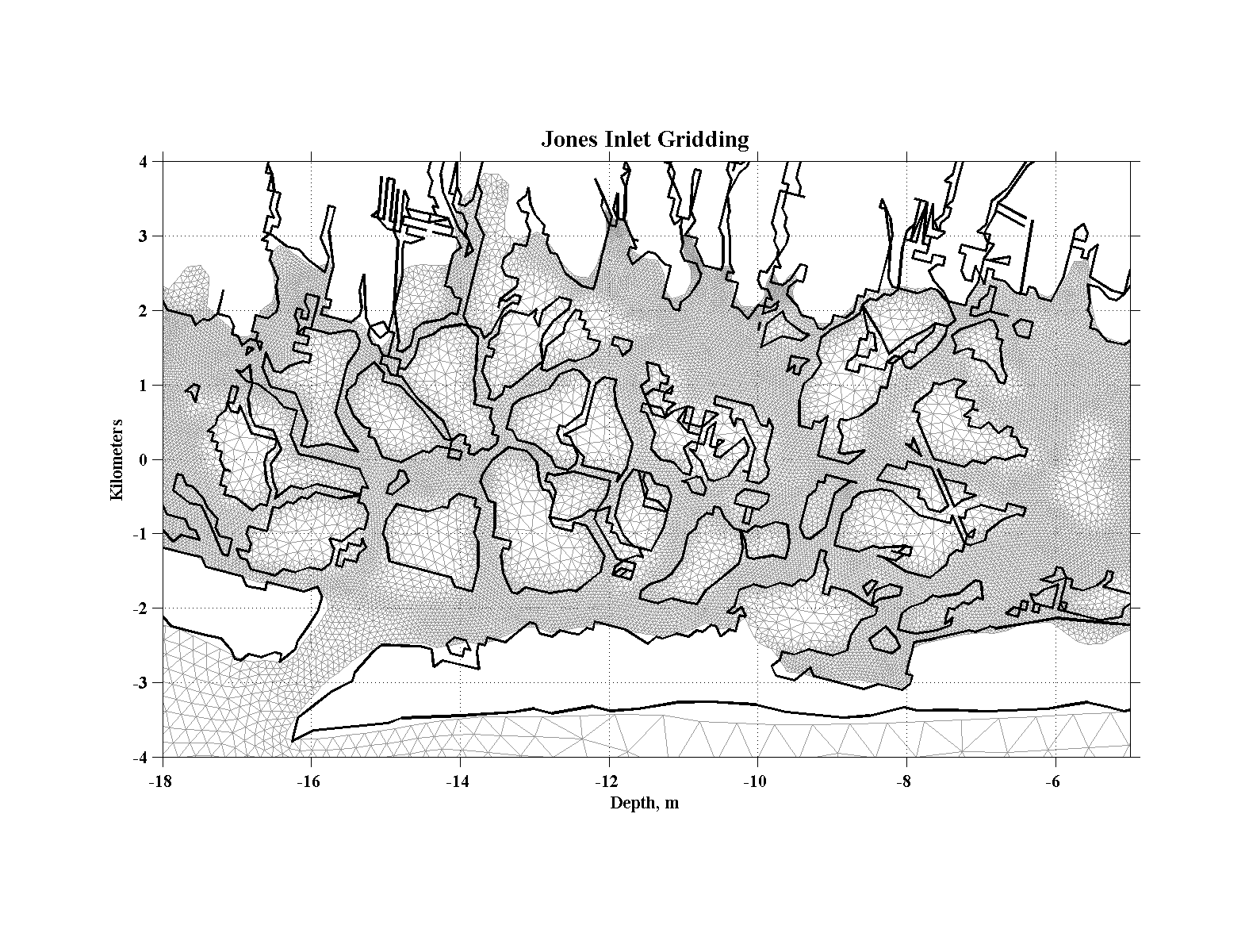
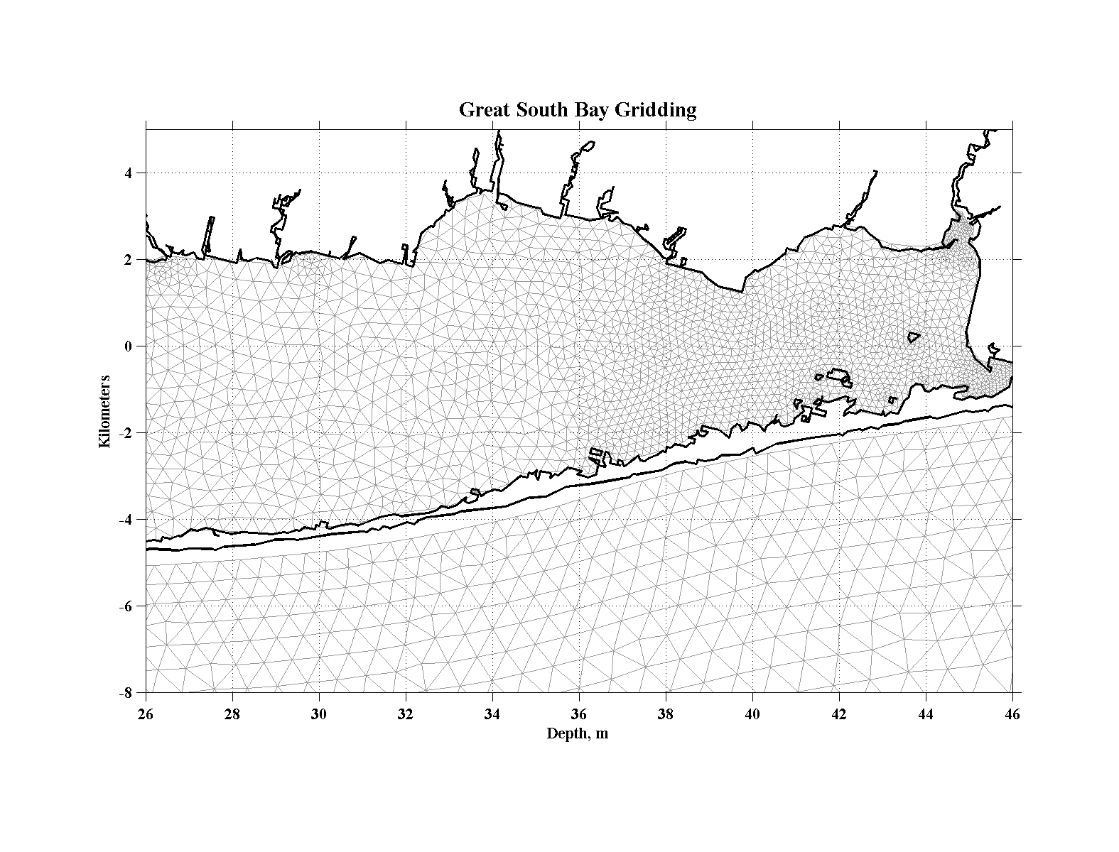
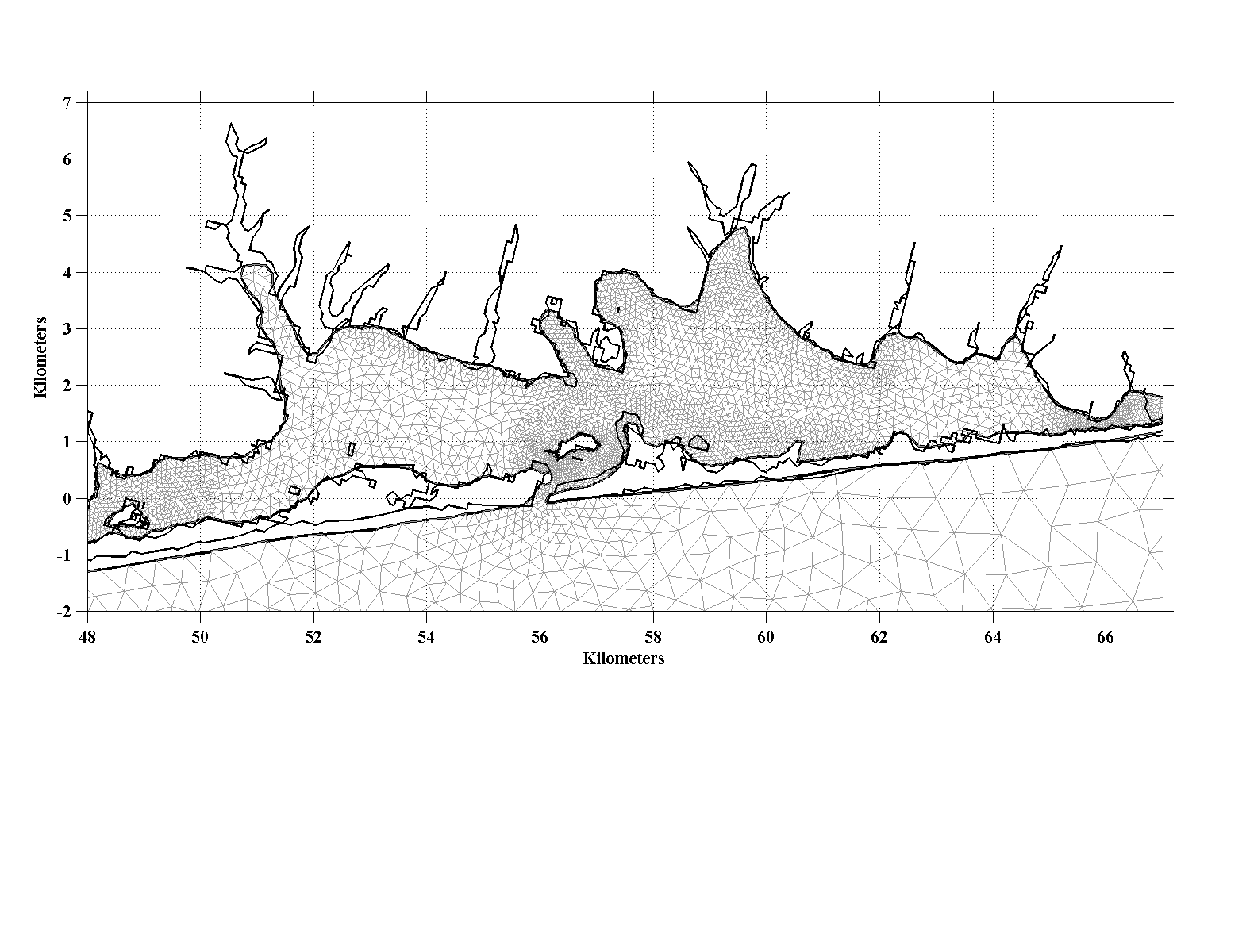
| The gridding for the model was
based upon the USGS HHW coastline using the SMS gridding routine.
Because of the channelized western end of the Bay, extensive and
iterative hand-editing of the grid in that area was required. In
the end, a total of 59531 nodes and 114637 triagular elements were
needed to represent the present-day conditions. Model bathymetry
was interpolated onto the grid from a combination of NOS survey data
and modern multi-beam data collected by Roger Flood in the central and
eastern Great South Bay since 2001 while USGS seamless topography data
was used to define the marsh elevations in the western reaches of the
domain. |
||||||||
|
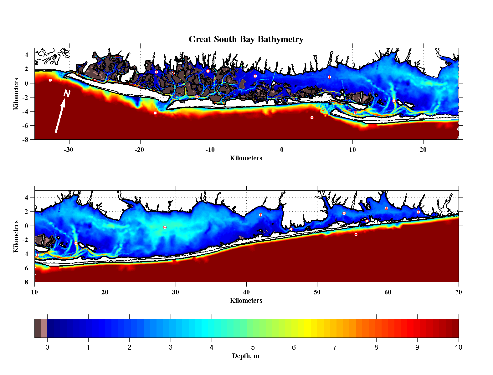
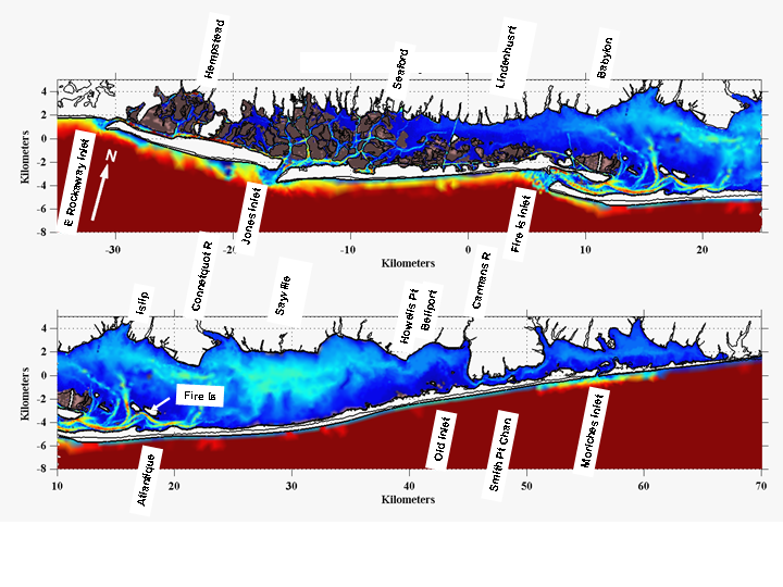
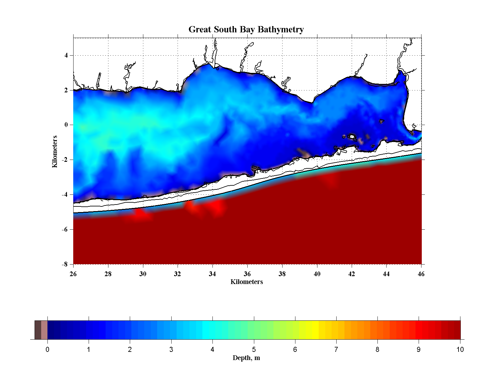
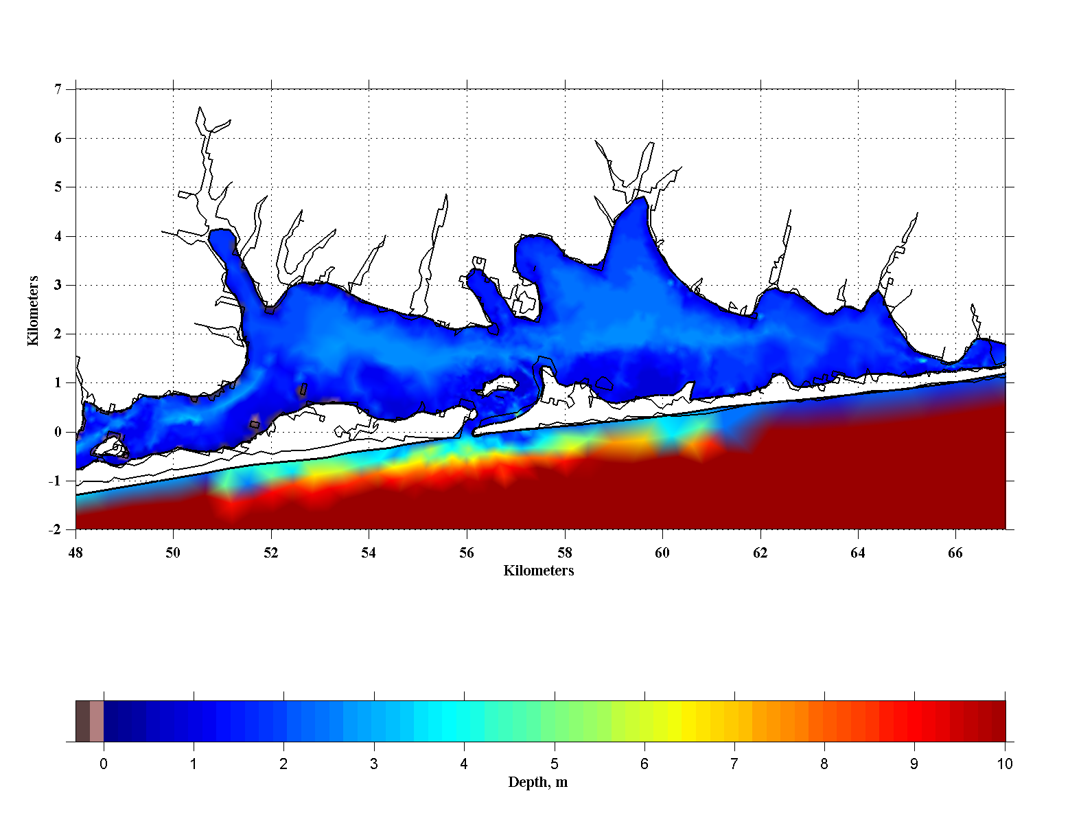
The final model
bathymetry for the
Great South and Moriches Bays for
the current conditions/base-case runs is shown to the left while an
annotated bathymetric map to the right shows the locations of
points interest discussed in the text.