![]()
![]()

|
|
|
|
Breach
at Old Inlet
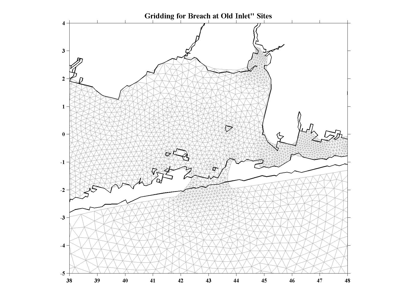
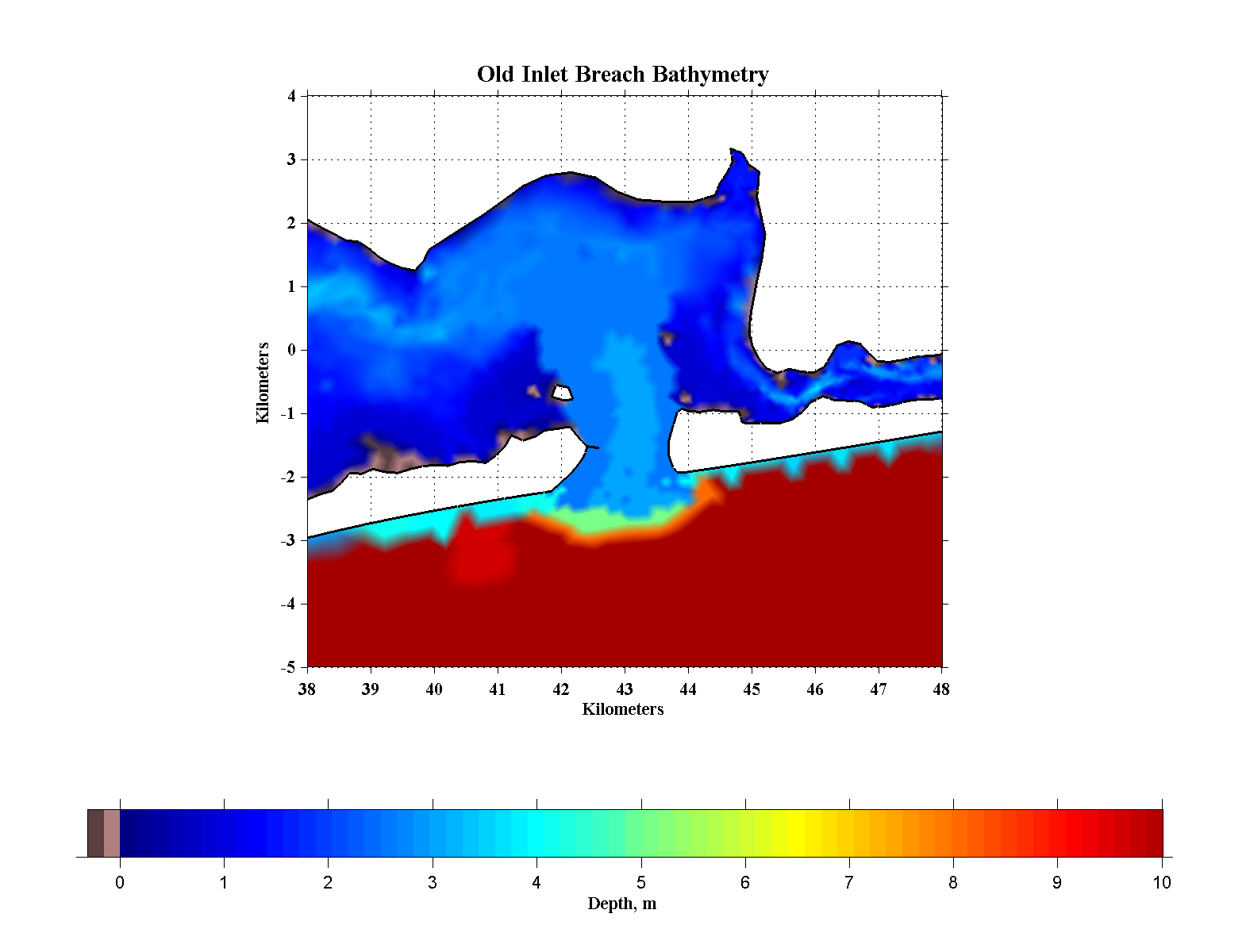
| Gridding - Historically, the Smith Point Channel area and extending west into Great South Bay have been locations for barrier island breaches. Sometimes these have closed quickly on their own while at other times the breaches have lasted for years. So one of the obvious places to place a breach was in this area and the Old Inlet was a logical place since it already experiences periodic washovers. The figures to the right show the modifications made to the base-case grid to simulate a developed and approximately stable inlet at this location. The breach measures 1.3 km across at its narrowest point with a cross-section of about 3600 m2 (39,000 ft2). The current conditions in the backbay area of Old Inlet are quite shallow, unrealistically so if a breach were to be established in this area. So as the bathymetry figure shows, we excavated a broad channel northward into the deep part of the Belport Bay to represent a more plausible backbay condition. For this scenario there were 60465 nodes and 116482 triangular elements. As in the base-case we ramped-up the Old Inlet breach simulation from an at-rest condition for 200,000 internal time steps (see discussion for the base-case). |
|
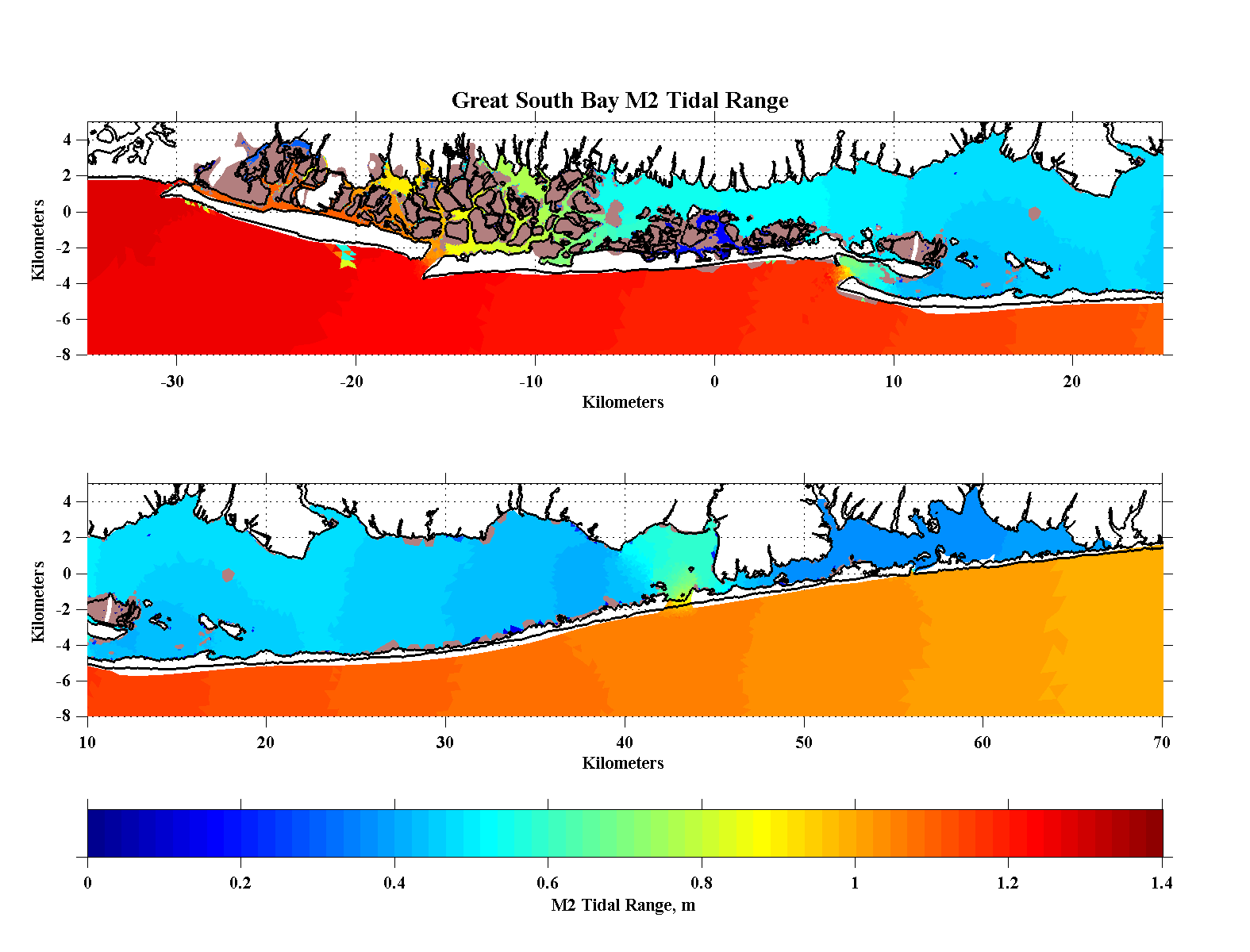
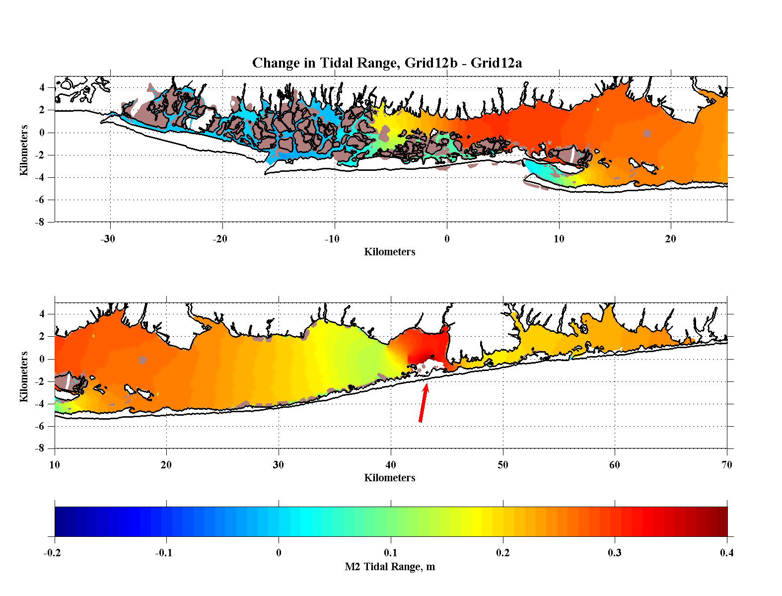
| Tidal Range - The opening at Old Inlet had a substantial effect on the tidal range (the difference between high and low tide) from Seaford (at -8 km) all the way through Moriches Bay. The upper panel shows the tidal range with the breach opening , Grid12b, while the lower panel shows the change in tidal range relative to current conditions, Grid12a. Currently, the tidal range for this same area is about 0.3 m but with Old Inlet open the tidal range for the central Bay increased to about 0.5 m throughout the central portion of the Bay, somewhat less immediately west of Howells Point while in Bellport Bay the tidal range increased to about 0.7 m. The saddle point in relative response just west of Howells Point (at 40 km) perhaps indicates some sort of interaction between the tidal forcing originating at Old Inlet and that from Fire Island Inlet. Between Seaford and Johns Inlet (-8 to -16 km) there is very little change in tidal range but there is a relative increase again in the channel north of Atlantic Beach and Long Beach. |
|
| Temperature and
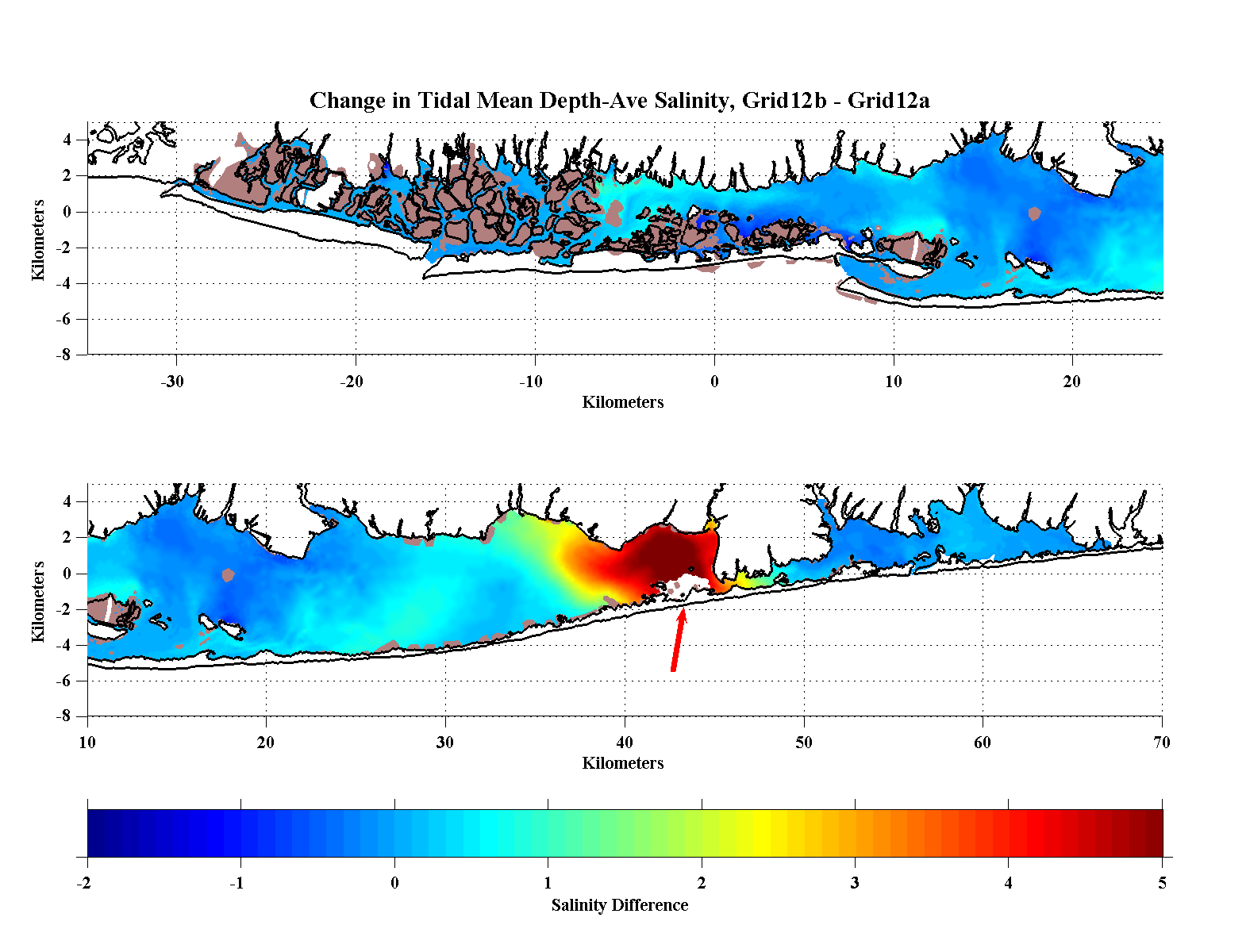
Salinity - As for the base-case, the simulation was started from rest with climatolgical temperature and salinity distributions. Temperatures are not forced in the present version of the model through air/sea interaction and so temperatures slowly equilibrate due to river and oceanic effects. Of course, the climatological salinities are grossly inappropriate for the eastern portion of the Bay so there was an immediate, tidally modulated increase in salinity in Bellport Bay (node 18173). The salinity increase in the Bay seems to have been largely confined to Bellport Bay although the node south of Sayville (node 37235, yellow) representing the large central portion of the Bay continues to show a gradual although small salinity increase (~0.2/day). Similarly, the salinities in Moriches Bay did not change too much. Given the proximity of Moriches Bay to Old Inlet one might have expected more of an impact by a breach at Old Inlet. A probable explanation is that these is a small westward mean flow through the Smith Point Channel due to the relative setup of Moriches Bay compared to the now open Bellport Bay area. Under current conditions there is a small westward flow through the Channel driven by the differential sea level set-up between the Bays and this does not seem to have been changed much by the presence of a new Old Inlet opening. This westward mean flow is slightly larger with the breach than in the base case but less than for the case with an opening at Atlantique. It is probable that the response would be very sensitive to slightly different inlet morphologies in and around an Old Inlet breach. |
|
| Tidal-Mean
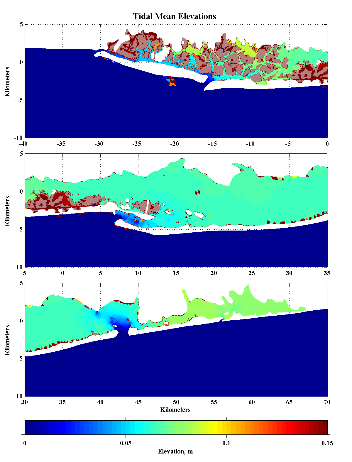
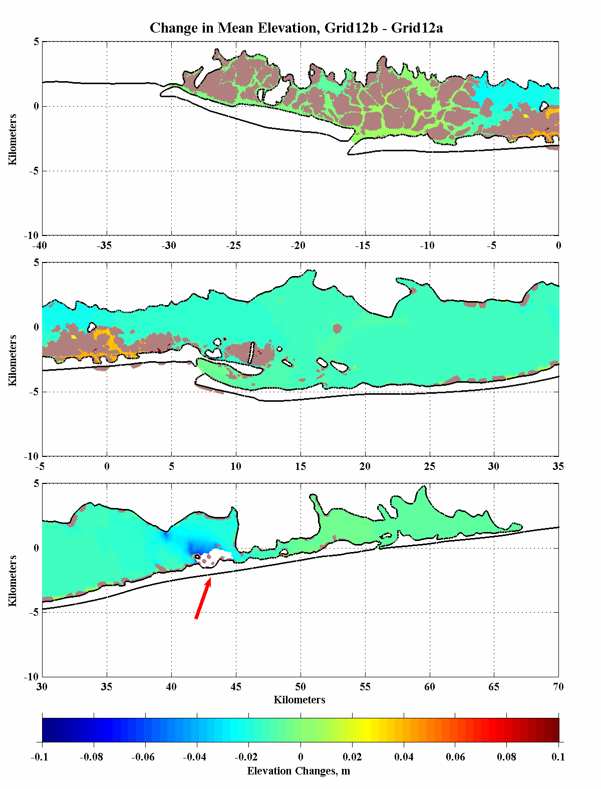
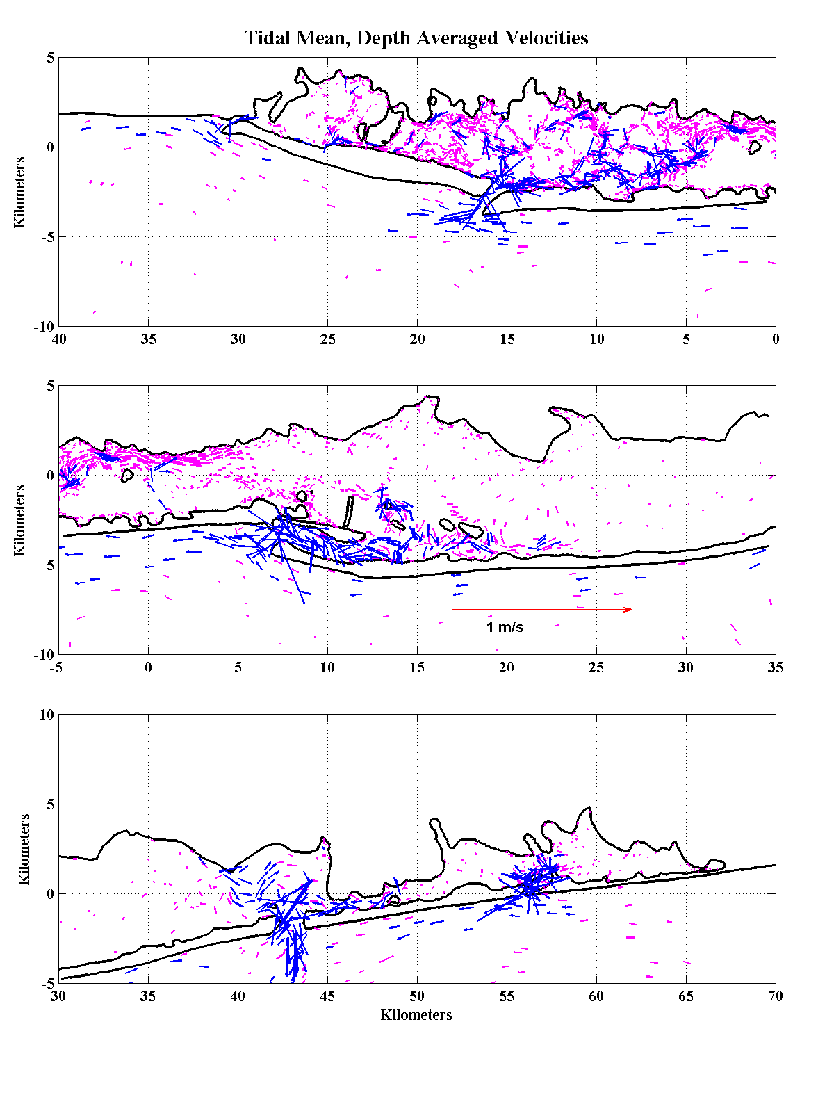
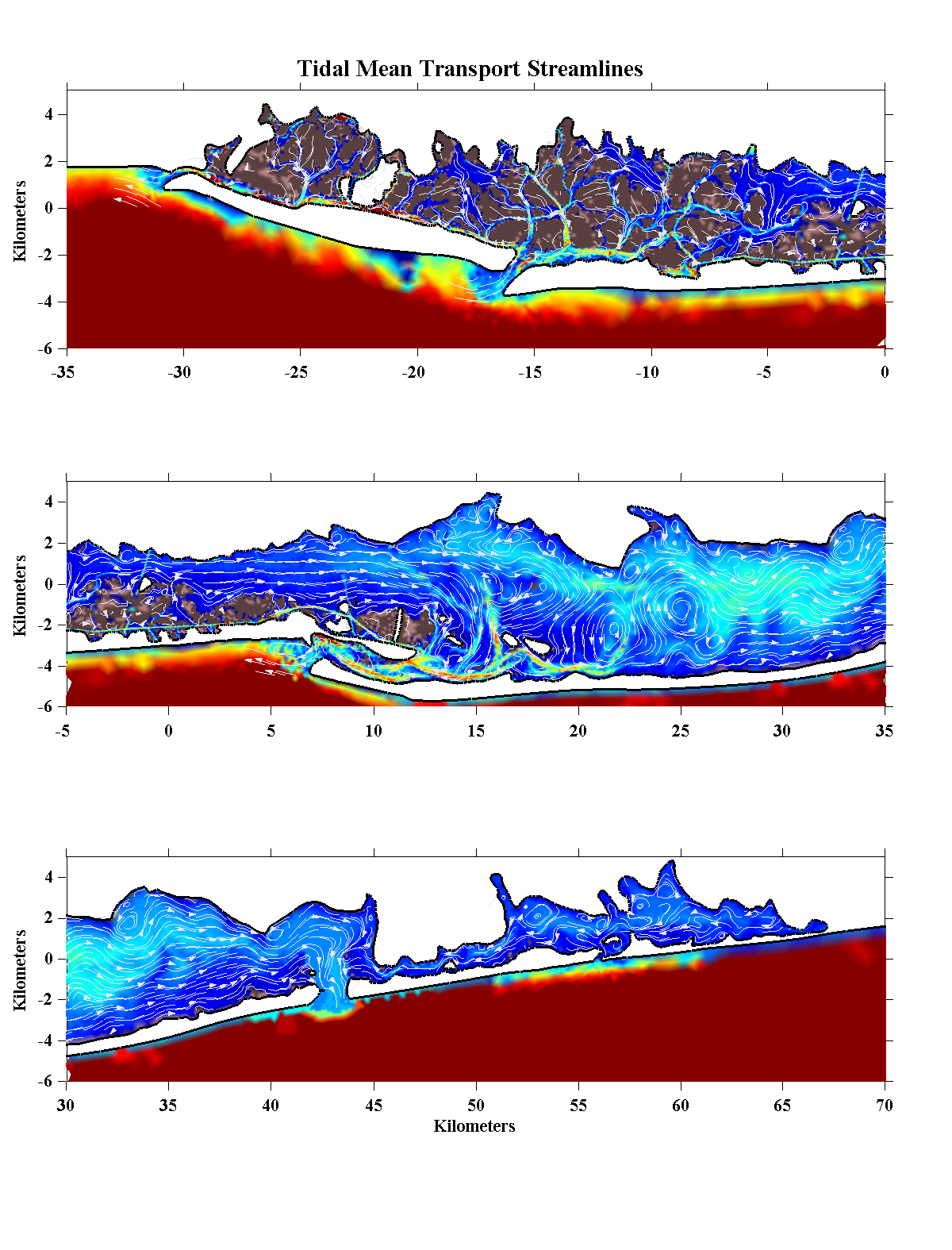
Conditions- The panels below show tidal-mean conditions from the last 12.4 hours of the ramp-up to stable conditions. With the breach opening at Old Inlet the mean elevation remains higher than on the shelf but the mean set-up is generally less than in the base except, oddly enough, for the area of the state boat channel south of Robert Moses Bridge and Cedar Island. In Bellport Bay the mean elevation is lower than before by a couple of centimeters because of the increased access to the ocean. In terms of salinity, the breach has increased the mean salinity in Bellport Bay and westward into Patchogue Bay. Given the evident westward propogation of the salinity, it's possible that we haven't quite reached an equilbrium state but it does seem as though the response in the larger central Bay will be rather muted. The overall tidal-mean, or residual currents are similar to the base-case except in the immediate vicinity of Bellport Bay where the eastward mean flow south of Howells Point seems to produce a anti-cyclonic eddy. The mean flow is still outward in Fire Island Inlet and in at the original three smaller inlets. The mean flow is westward but small through Smith Point Channel and out of the Old Inlet Breach. The last panel shows the tidal-mean transport streamlines which makes visualizing the flow patterns easier. The transport streamline figure again shows the interior residual motions with several but fewer eddies within the Bay as well as a dominance of the eastward flow out of Hempstead Bay. Compared to the current condition simulation, the presence of the Old Inlet breach has change the flowpattern to the east of Connectquot River. There are fewer eddies in the central and eastern portion of the Bay with a more organized flow pattern toward the breach which appears to originate in a clockwise eddy south of Connectquot. |
||||||||
|
||||||||
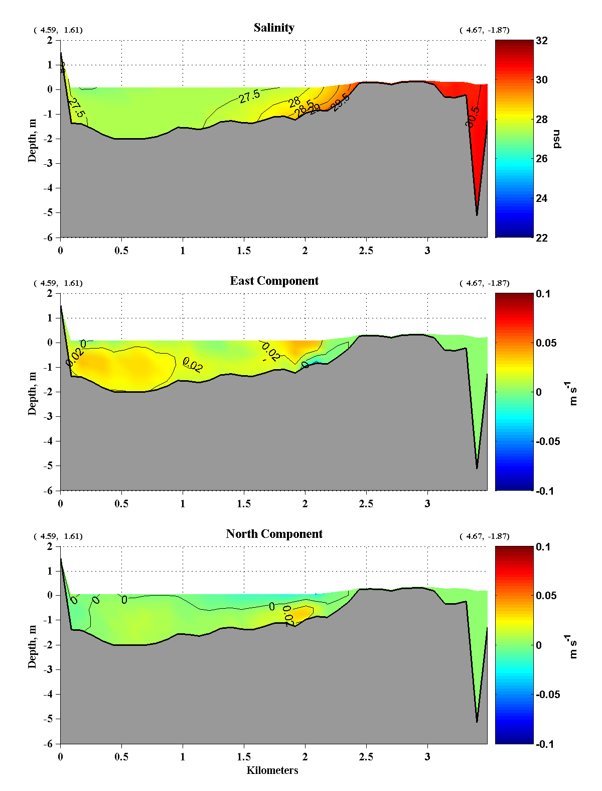
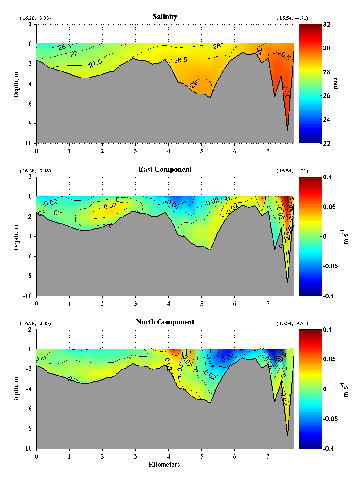
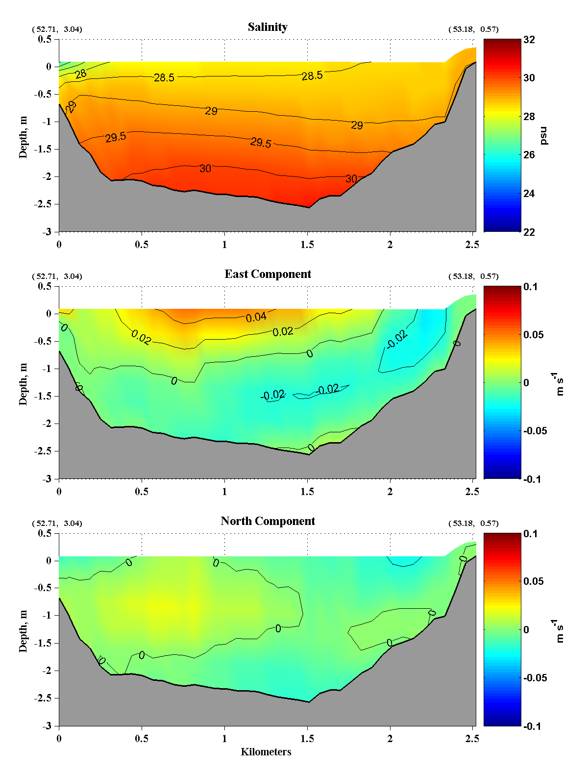
| Vertical Sections
A series of sections have been generated to show the vertical and
horizontal structure of the salintity and velocities under the Old
Inlet breach scenario. The chart below shows the locations of the
vertical sections while the lower panels show vertical sections of the
tidally-averaged
salinity and nominally, east and north velocity components. (The
velocity components have been rotated 15o to be
aligned along and across the Bay so that the "east" component is
actually toward 75oT while the "north" component is toward
345oT.) 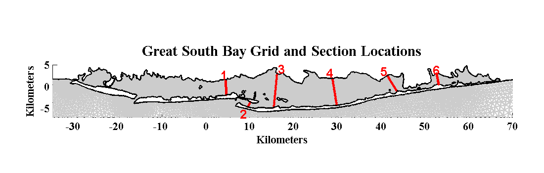
|