During the first OMP deployment, from February 5 to May 12, 1996, a total of 126 instruments recording temperature and usually conductivity were distributed among the 26 moorings. This has resulted in a dense enough sampling of water properties to enable us to generate a fairly complete 3-D picture of the seasonal development of the hydrographic structure in the region. For this purpose, the temperature and salinity data from those instruments have been extensively recalibrated so that the records are now consistent with instruments on the same and on nearby moorings and with CTD casts from EN280. (Hydrocasts from the deployment and retrieval cruises were of little use for calibrating the instruments because there was significant stratification during those times whereas EN280 took place after a major wind event when conditions were generally well mixed.) The recalibrated data reside in a long series of matfiles which have been reformatted and are now accessible through the web as ascii files.
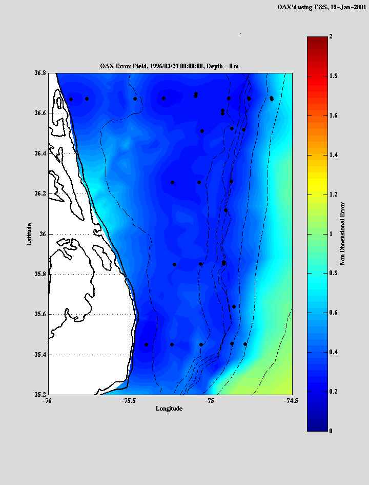
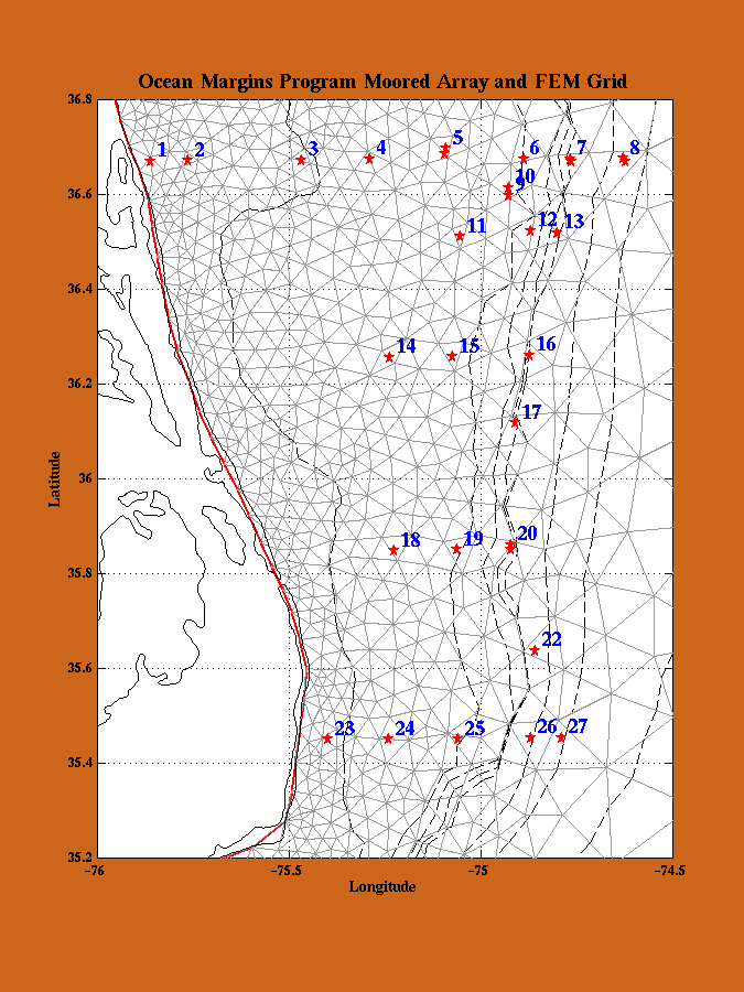
Using the calibrated data, the properties have been objectively mapped onto a 3-D finite-element grid for the OMP region (shown below) with reasonable confidence in the resulting distributions. The mapping errors which is not shown in the animation, give the expected result of low error in areas with moorings, moderate error between the moorings and the shore, and significant error offshore and outside the array. An example of the error field for the surface plots in mid-March is shown below. It is now possible to generate vertical sections along arbitrary transects as well as horizontal maps at any depth and for any time period. Using these methods, two-day averages were mapped onto the grid to generate time series of sections and maps which we have combined into hydrographic animations for the duration of the first deployment. The animations include cross-shelf sections along the northern and southern mooring lines, two more along-shelf sections over approximately the 40m and 60m isobaths, and maps of surface, bottom, and surface minus bottom temperature, salinity, and density. The animation is in the form of a *.hav file (~60Mb) which can viewed on a PC using the MOYAGER freeware viewer from Gromada. To control the animation, click the right mouse bottom. You can pause the animation at any time or slow it down by changing the frame rate using the options.
Click here to retrieve the animation.